


Lisbon Street Views--Before the Internet
Looking at vintage postcards shows how our cities once were--which isn't to say they were "better", but that they and the people these show were, well, different

And just like that, the Erich Sonntag Postcard Collection will take you on a trip through Lisbon, Portugal—almost like Google’s Street View, albeit with images from before the internet.
In case you missed the first part, please click here:

Lisbon How it Once Was
Let me take you by the hand and take you through the streets of Lisbon…

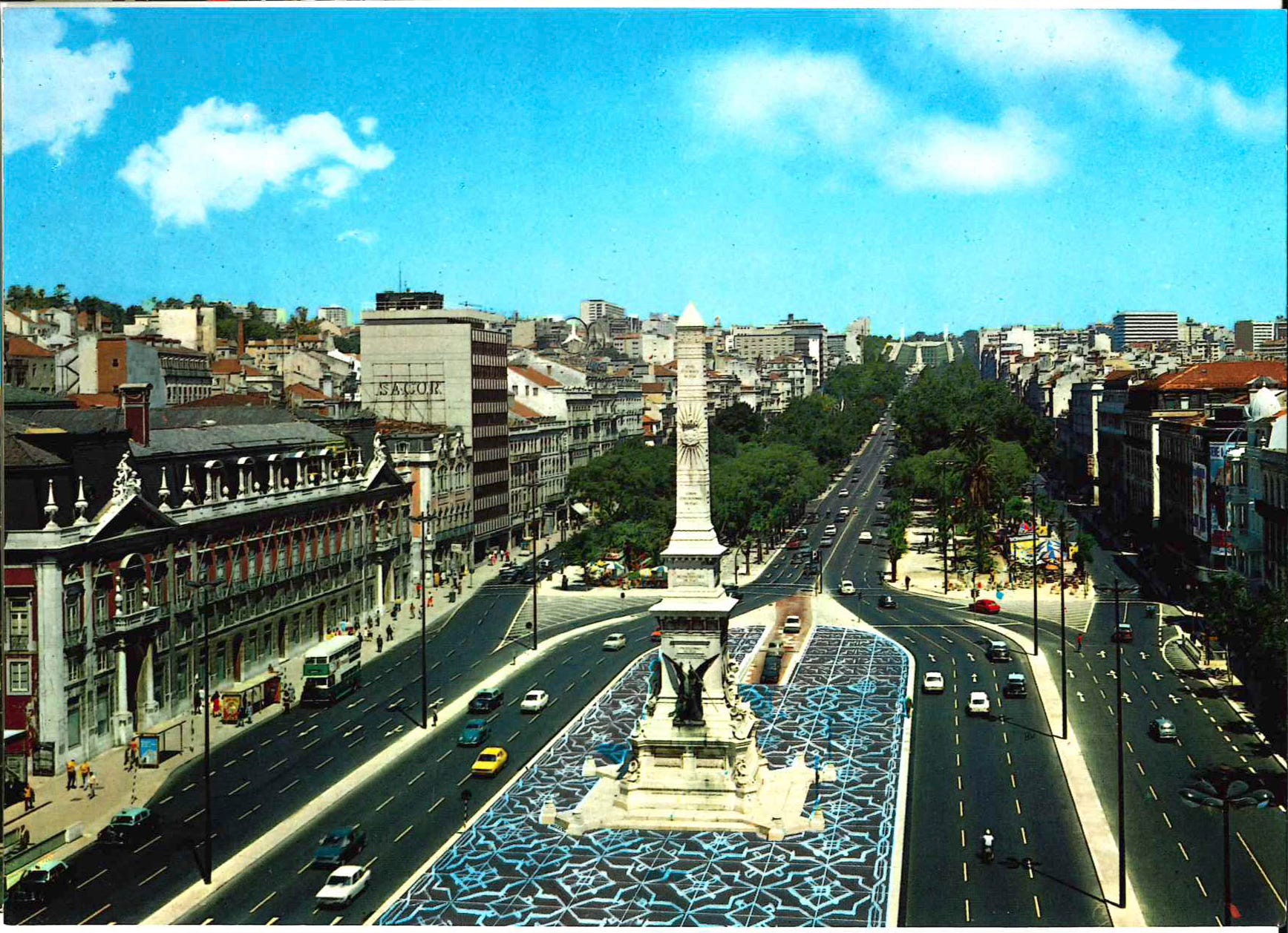
We’ll start with this nice specimen showing the 24 July Avenue, Lisbon’s main coastal/harbour thoroughfare as mailed in 1956.
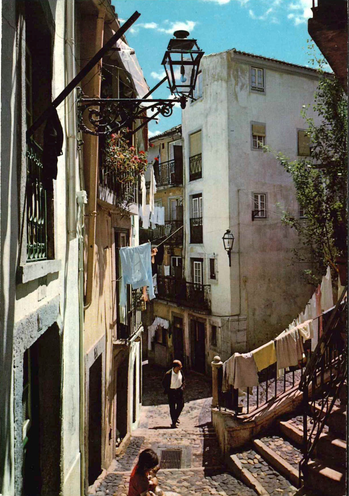
While I’m certain local knowledge might help identify that particular corner, this postcard merely holds “a place in Alfama”, all I can do is post about what that part of the city means (via Wikipedia):
The Alfama is the oldest neighborhood of Lisbon, spreading on the slope between the São Jorge Castle and the Tagus river. The district includes the freguesias (parishes) of São Miguel, Santo Estêvão, São Vicente de Fora and part of the two streets, “Freguesia da Sé: Rua do Barão” and “Rua São João da Praça”. It contains many important historical attractions, as well as an abundance of Fado bars and restaurants.
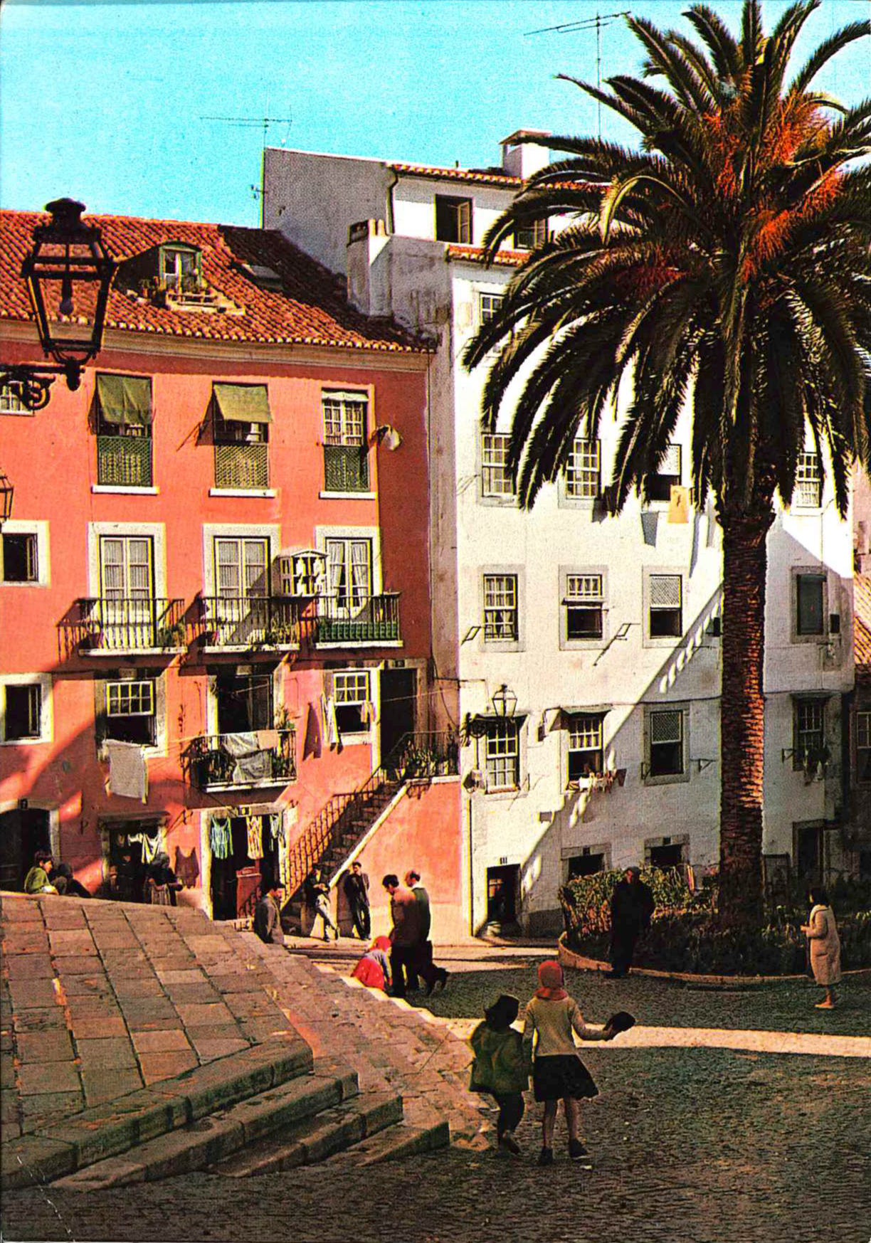
So, it’s right in the centre of the old town—it looks nice, much like the postcard below, which also shows a “typical street in Aflama”, mailed in 1969:
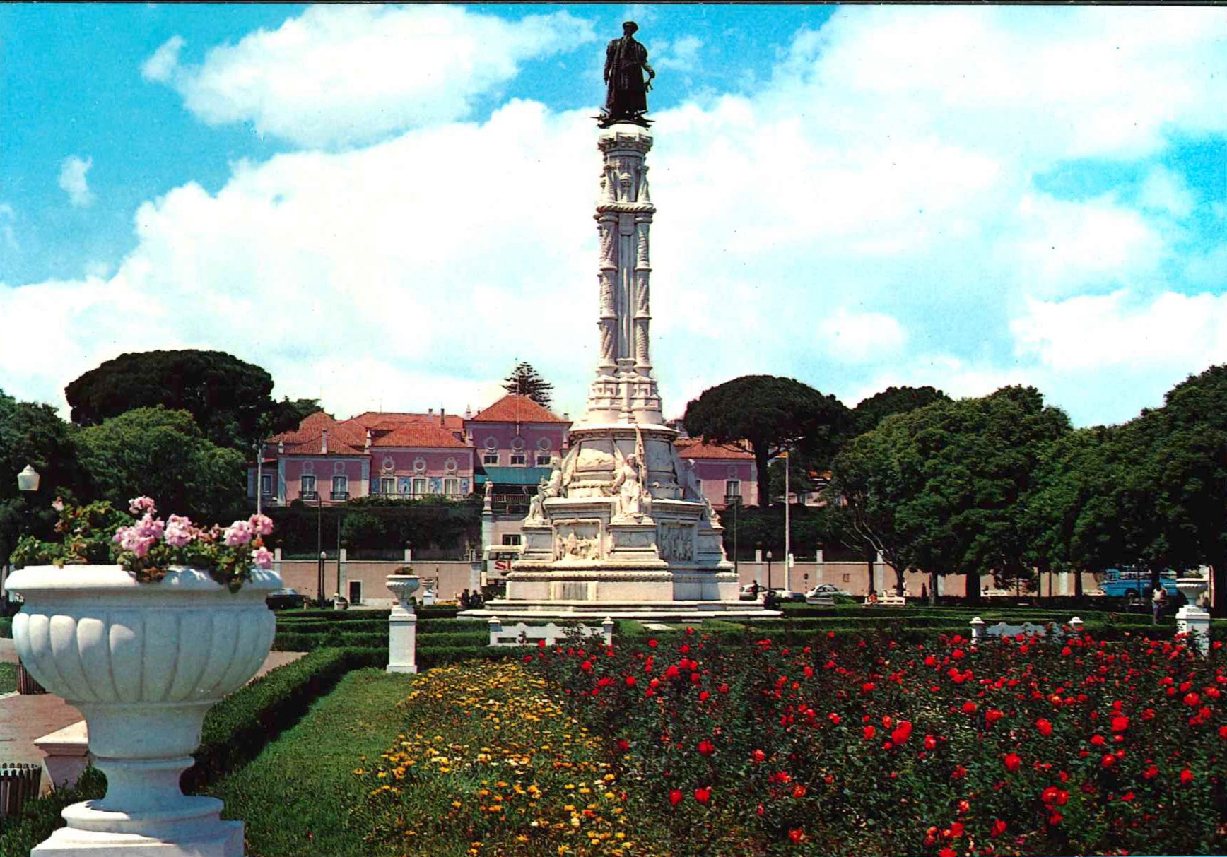
Behold Dom Alfonso de Albuquerque Square, which “is located in front of Belém Palace, an early 18th-century palace that nowadays serves as residence for the President of Portugal. The square…offers the best views of Belém Palace”, according to Wikipedia:
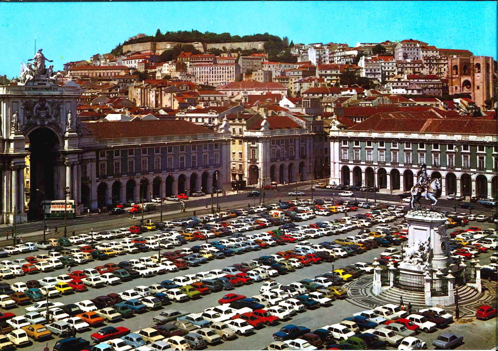
I think it is from the late 1960s or early 1970s, as indicated by the then-en vogue conversion of virtually all urban spaces into parking lots, much like the Plaça do Comércio below:
Speaking of squares, main thoroughfares, and representatives boulevards of Lisbon would not be complete without the Avenida da Liberdade, or Avenue of Liberty, which is “a boulevard in central Lisbon, Portugal, and is considered among the most expensive streets in Europe.[1] Originating in the Passeio Público, an 18th-century park built for the Portuguese nobility, the avenue was built in 1879, when the former park was turned into a major boulevard, marking the northward expansion of the city during the 19th century. The Avenida is also home to numerous embassies and diplomatic missions.” Thus spake Wikipedia.
Bonus Postcard: “Regular” Lisbon
It is almost inevitable to start with “typical” things—and end up on one of Europe’s most expensive boulevards if you’re looking at picture postcards. Hence, I shall add one more image that shows a bit more “down-to-earth” aspects of Lisbon’s Luís Vaz de Camões Square and how it once was:
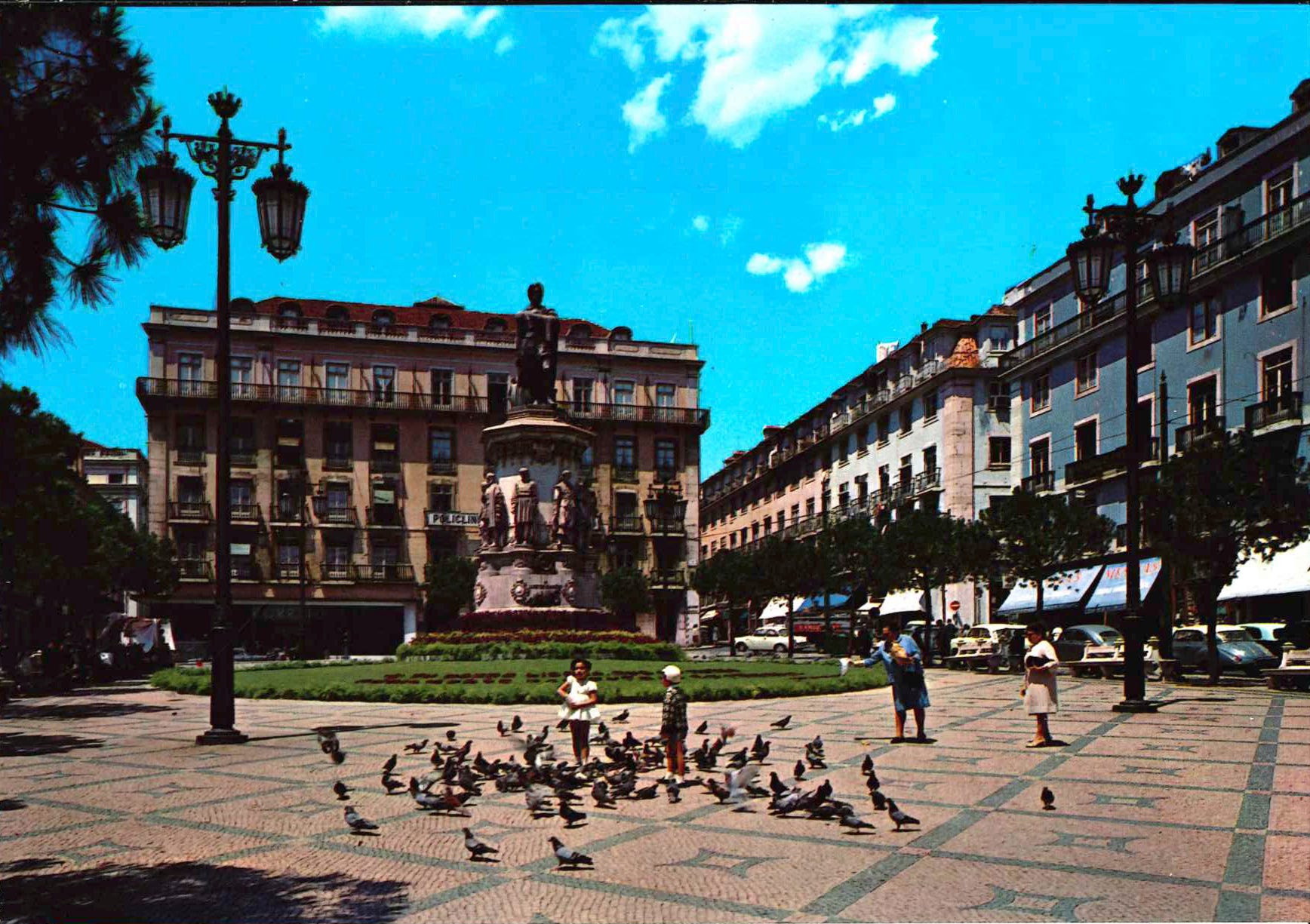
The square is named after “Portugal’s greatest poet. His mastery of verse has been compared to that of Shakespeare, Milton, Vondel, Homer, Virgil and Dante. He wrote a considerable amount of lyrical poetry and drama but is best remembered for his epic work Os Lusíadas (The Lusiads). His collection of poetry The Parnasum of Luís de Camões was lost during his life. The influence of his masterpiece Os Lusíadas is so profound that Portuguese is sometimes called the ‘language of Camões’.”
Curiously enough, it would seem that in our post-modern era, we only name things after very much lesser people, which I consider a clear sign of decadence.
I prefer the old streets, when people watched each other in their spare time and looked for opportunities to interact.
It’s a sad world