


Then and Now: Temple of Kukulcan at Chichén Itzá, Mexico
Finally, a third instalment of these awesome structures in picture postcards from the 1920s

Reference is made to the prior postings in this particular series:


As promised, today’s armchair trip will take us to the Yucatán peninsula, specifically to the awe-inspiring site of Chichén Itzá’s, which, as Wikipedia summarises so aptly,
was one of the largest Maya cities and it was likely to have been one of the mythical great cities, or Tollans, referred to in later Mesoamericanliterature. The city may have had the most diverse population in the Maya world, a factor that could have contributed to the variety of architectural styles at the site.
One of the quite canonical images of the site is, of course (again Wikipedia, but from a different entry),
El Castillo, also known as the Temple of Kukulcan is a Mesoamerican step-pyramid that dominates the center of the Chichen Itza archaeological site in the Mexican state of Yucatán. The temple building is more formally designated by archaeologists as Chichen Itza Structure 5B18.
Built by the pre-Columbian Maya civilization sometime between the 8th and 12th centuries AD, the building served as a temple to the deity Kukulcán, the Yucatec Maya Feathered Serpent deity closely related to Quetzalcoatl, a deity known to the Aztecs and other central Mexican cultures of the Postclassic period. It has a substructure that likely was constructed several centuries earlier for the same purpose.
I suppose many of you, dear readers, have seen the images of this magnificent structure (and there’s certainly no shortage of them on Wikipedia).
But I wager that not many of you have seen an image of the Temple of Kukulcan as it stood there a century ago, and I think some of you have been ‘there’, too:
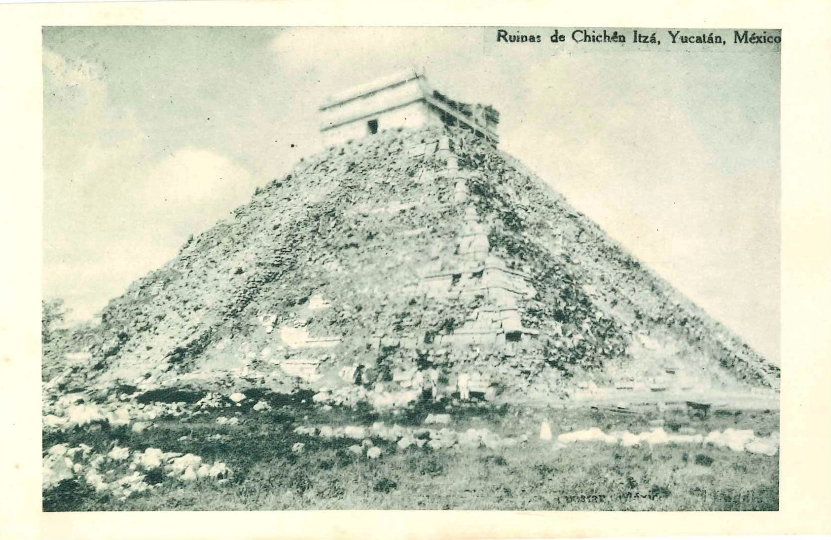
On the reverse of this (unmailed) postcard from the 1930s, the following description is found:
Ruins at Chichén Itzá, Yucatán, Mexico.—These ruins dating from the times of the Mayans civilization are scattered over an extensive area. The diverse groups of buildings are disposed around a large central courtyard.
How do I know the timing? Well, the second linked Wikipedia entry explains:
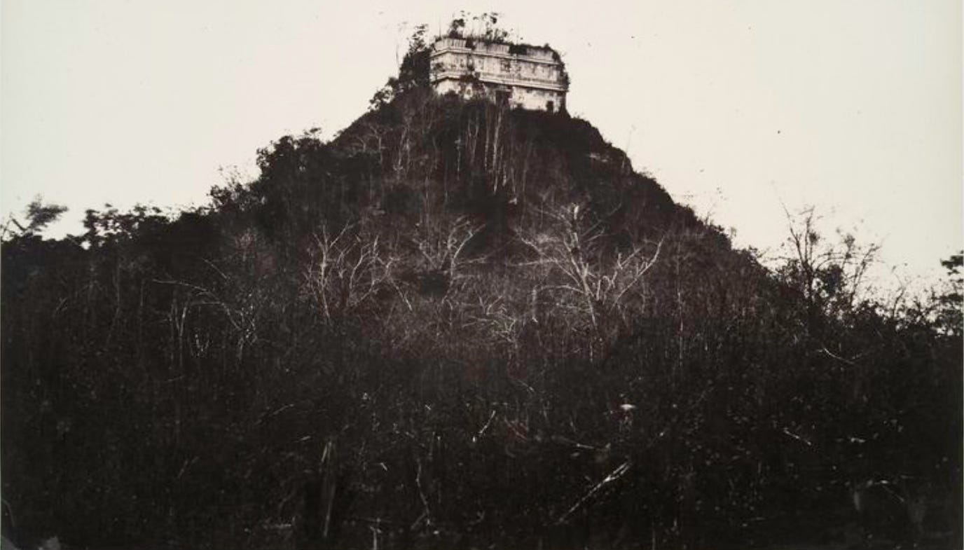
John Lloyd Stephens described the architecture of the temple with even more detail in his book Incidents of Travel in Yucatán (Incidentes del viaje Yucatán), published in 1843. At that time, the archaeological site of Chichén Itzá was located on an estate, also called Chichén Itzá, owned by Juan Sosa. Frederick Catherwood illustrated the book with lithographs depicting the temple covered in abundant vegetation on all sides. There are some photographs taken in the beginning of the twentieth century that also show the temple partially covered by said vegetation.
I found this image at the Wikipedia page to show you what that pyramid looked like a bit before the state that is shown in the above postcard (source):
In 1924, the Carnegie Institution for Science in Washington, D.C. requested permission from the Mexican government to carry out explorations and restoration efforts in and around the area of Chichen Itza. In 1927, with the assistance of Mexican archaeologists, they started the task. In April 1931, looking to confirm the hypothesis that the structure of the temple of Kukulcán was built on top of a much older temple, the work of excavation and exploration began in spite of generalized beliefs contrary to that hypothesis…
From the first linked Wikipedia article, we learn the following
In 1923, the Mexican government awarded the Carnegie Institution a ten-year permit (later extended by another ten years) to allow U.S. archeologists to conduct extensive excavation and restoration of Chichen Itza.[35] Carnegie researchers excavated and restored the Temple of Warriors and the Caracol, among other major buildings. At the same time, the Mexican government excavated and restored El Castillo (Temple of Kukulcán) and the Great Ball Court.
Excavations were essentially complete by the mid-1930s, hence we may more accurately date the above postcard to the decade after 1924.
Isn’t this an awesome image, then? (Especially, as I’ve not seen anything like this in the Wikipedia Commons repository.)
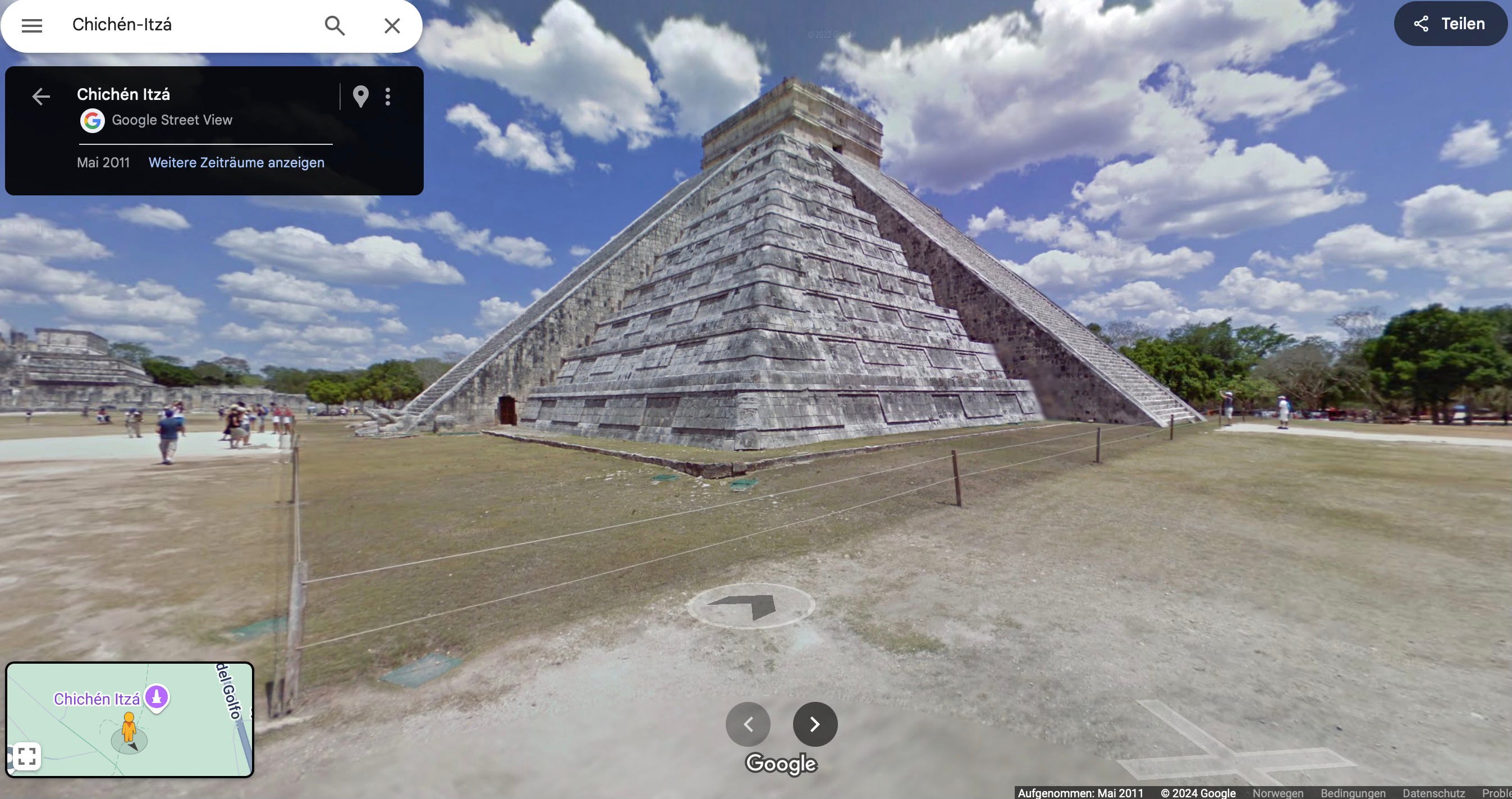
Oh, lest I forget, this is what it looks now (via Google Maps):
And since we’re in the area, I shall post some more images of Chichén Itzá’s glorious sites in the 1920s next. Stay tuned!
WOW. This was phenomenal, thanks.
Edit: Ugh. I showed my family and they told me to tell you "thanks for showing us the alien temple!"
When we were there in 2006 we climbed up to the top. They don’t allow that now I hear. It was very steep and coming down was scary. We also went up the inside stairs to the secret room.